EU ERASMUS+ project 15.10.2017-14.10.2020
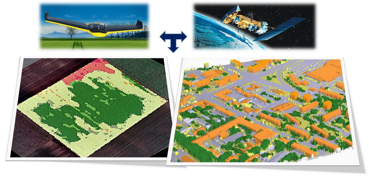
The EU space strategy in the document “2016 Communication on a Space Strategy for Europe” fosters the uptake of space techniques applications. "The Commission’s aim is to optimise the benefits that space brings to society and the wider EU economy. Achieving this means boosting demand among public and private users, facilitating access to and use of space data, and stimulating the development and use of innovative downstream applications." The demand is in line with the practice observed in the field of Remote Sensing (RS), which has wide range of potential applications unused.
The wider objective of the project is to develop an innovative learning platform, a Learning Management System (LMS) for Asian countries, China and Thailand, which has already relevant activity in the field of RS. Though the content of the proposed LMS would not correspond to any level of tertiary level education, it is basically planned to be developed for meet MSc standards to BSc of related disciplines to RS.
More specifically it is planned by improving the related education
1) by establishing LMS at each Asian universities,
2) by creating a Knowledge Pool of high level eLearning teaching materials for a wider scientific and engineering community, and
3) by organizing workshops, a trainings and a summer school for the teaching staff and students.
Specific Project Objectives:
To ensure researchers and academic staff in RS and geospatial sciences for studies integrated into world-wide sustainability academia (research) community
To strengthen and integrate RS and geospatial science into Multi-Inter-Trans-Cross- Disciplinary sustainability studies and research of Socio-Ecological Systems
To enhance the role of Asian institutions in socio-ecological systems studies and researches for the benefit of Asian region
To promote internationalization on the relevant knowledge areas
To enhance international cooperation between EU and Asian universities and research institutes
The promotion of the professional development of staff and youth workers in the field of remote sensing and related interdisciplinary sciences is planned to be implemented in the form of a Learning Management System, which makes use of recent advancements of ICT methodologies and technologies. Transversal skills, e.g. digital competences, or in general, 21th century skills are developed by the proposed education form, i.e. a practical remote teaching in a true multi-organizational collaboration.
The proposed LMS would host 20 newly developed modules on remote sensing in the curricula of participating universities, improving the quality of higher education, delivering a background for studying the practical use of the remote sensing techniques. This would by time enhance the practical use of remote sensing on a wide range of applications serving the labour market and society. The competences and skills in the participating HEIs will be developed by the use of these learning modules.
The LMS proposed to be developed at 4 Asian universities would serve the practical applicability of remote sensing data for wide range of disciplines (including different tasks of Environmental protection, Agriculture, forestry and fishery, Physical sciences, Engineering and engineering trades, Transport services, Security services). The aim of the LMS is to foster the uptake of remote sensing applications to boost the benefits that space brings to society and the wider economy.
Partners
1) Obuda University, Hungary
2) University of Natural Resources and Life Sciences, Austria
3) Jagiellonian University, Poland
4) University of Twente, Netherlands
5) Fujian Normal University, China
6) Yunnan Normal University, China
7) Asian Institute of Technology, Thailand
8) Khon Kaen University, Thailand
Budget: 990044 EUR


.jpg)
.jpg)